 Last additions - Pilbara negative and digital Albums - non iron ore |

205-28558 viewsKoodaideri, saddle back track looking down on the Fortescue valley north.Aug 24, 2014
|
|

205-27558 viewsYampire Gorge, asbestos sign, Pope Searle getting some fibre.Aug 24, 2014
|
|
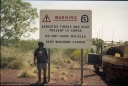
205-26649 viewsYampire Gorge, asbestos sign, Pope Searle getting some fibre.Aug 24, 2014
|
|

205-25527 viewsDrillers Ridge, Wittenoom, the DME (Distance Measuring Equipment) tower (located at 957 metres) was a navigation aid for the Department of Civil Aviation for the Wittenoom airport, the site was also used by Telecom for providing 'radio links' for phones into Wittenoom prior to the current tower located at the eastern edge of town which links back to Auski Roadhouse.Aug 24, 2014
|
|
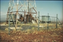
205-24588 viewsDrillers Ridge, Wittenoom, the DME (Distance Measuring Equipment) tower (located at 957 metres) was a navigation aid for the Department of Civil Aviation for the Wittenoom airport, the site was also used by Telecom for providing 'radio links' for phones into Wittenoom prior to the current tower located at the eastern edge of town which links back to Auski Roadhouse.Aug 24, 2014
|
|
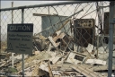
205-23551 viewsDrillers Ridge, Wittenoom, the DME (Distance Measuring Equipment) tower (located at 957 metres) was a navigation aid for the Department of Civil Aviation for the Wittenoom airport, the site was also used by Telecom for providing 'radio links' for phones into Wittenoom prior to the current tower located at the eastern edge of town which links back to Auski Roadhouse.Aug 24, 2014
|
|

205-22526 viewsWittenoom, upper reaches of Bee Gorge, landscape views.Aug 24, 2014
|
|

205-21531 viewsWittenoom, upper reaches of Bee Gorge, landscape views.Aug 24, 2014
|
|
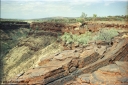
205-20671 viewsWittenoom, upper reaches of Bee Gorge, landscape views.Aug 24, 2014
|
|
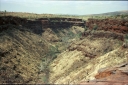
205-19624 viewsWittenoom, upper reaches of Bee Gorge, landscape views.Aug 24, 2014
|
|

205-18629 viewsWittenoom, top of Bee Gorge, Pope decided it was time for bacon and egg sangos, looking south, location is 22 17'46.38" S 118 15'50.08" E, 688 metres.Aug 24, 2014
|
|
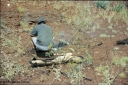
205-17704 viewsWittenoom, top of Bee Gorge, Pope decided it was time for bacon and egg sangos, location is 22 17'46.38" S 118 15'50.08" E, 688 metres.Aug 24, 2014
|
|
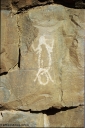
205-16589 viewsWittenoom, Bee Gorge, rock carving.Aug 24, 2014
|
|

205-15607 viewsWittenoom, Bee Gorge, rock carving.Aug 24, 2014
|
|
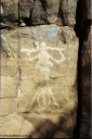
205-14640 viewsWittenoom, Bee Gorge, rock carving.Aug 24, 2014
|
|
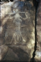
205-13669 viewsWittenoom, Bee Gorge, rock carving.Aug 24, 2014
|
|
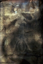
205-12623 viewsWittenoom, Bee Gorge, rock carving.Aug 24, 2014
|
|

205-11701 viewsWittenoom, Bee Gorge, rock carving.Aug 24, 2014
|
|
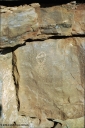
205-10626 viewsWittenoom, Bee Gorge, rock carving.Aug 24, 2014
|
|

205-09657 viewsWittenoom, Bee Gorge, rock carving.Aug 24, 2014
|
|
| 547 files on 28 page(s) |
 |
|
|
|
|
|
|
|
14 | |
|
|
|
|
|
|
|
 Login


