 Most viewed - 030405 |
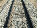
030405 154328542 viewsLock, track view of the narrow gauge per way showing the dilapidated state of the sleepers hence the 20 km/h speed limit! April 5, 2003.
|
|
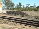
030405 145612538 viewsWarramboo, track view across to loading ramp located at the northern end of the sidings, April 5, 2003.
|
|
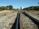
030405 154418535 viewsLock, yard overview looking south from the northern end with a kink in the mainline with the points for the siding, silo complex visible in the background, April 5, 2003.
|
|
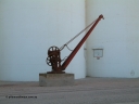
030405 150048532 viewsWarramboo, view of yard crane in front of concrete silo complex, the 5 ton crane is ex Port Lincoln, April 5, 2003.
|
|

030405 160936532 viewsLock and District Historical Museum, original Peachna railway station sign on the side of the former lock portable station office building. April 5, 2003.
|
|

030405 160148525 viewsLock, barracks, shows the extension added in 1969. April 5, 2003.
|
|
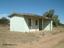
030405 145628522 viewsWarramboo, station located at the 190.2 km and originally opened in May 1913, north west view of station building and shelter, April 5, 2003.
|
|
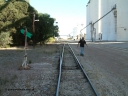
030405 155300517 viewsLock, yard overview looking south, points and lever with indicator for the siding off the mainline, concrete silo complex Block 2 and outflow spout visible on the right as local identity Pope Searle wanders around the yard. April 5, 2003.
|
|

030405 155516517 viewsLock, yard overview looking south along the mainline, horizontal grain shed with siding on the left, Ascom style silo complex Block 5 with outflow spout on the right with goods shed and platform also visible. April 5, 2003.
|
|

030405 161656511 viewsLock, former yard crane, hand operated 5 ton revolving jib crane and plinth, now located off North Terrace, April 5, 2003.
|
|
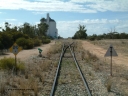
030405 150340509 viewsWarramboo, yard overview looking north with siding point levers and indicators, 20 km/h speed restriction signs, concrete SACBH silo complex on the left, April 5, 2003.
|
|
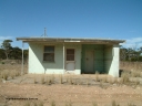
030405 145711504 viewsWarramboo, station located at the 190.2 km and originally opened in May 1913, front or western elevation view of station building and shelter, April 5, 2003.
|
|
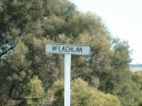
030405 153219502 viewsMcLachlan, station located at the 156 km, originally opened in September 1914 and called 97 Miles till 1915, closed in August 1972, modern location signpost, April 5, 2003.
|
|
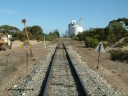
030405 154311500 viewsLock, yard overview looking south from the northern end with speed limit and whistle boards, points and point lever and indicator for siding, silo complex visible in the background, April 5, 2003.
|
|

030405 155752490 viewsLock, yard overview looking north along the grain siding, mainline to the right, Ascom style silo complex Block 5 with outflow spout visible on the left, point lever and indicator for horizontal grain shed siding in the middle of frame, and transfer auger across tracks. April 5, 2003.
|
|
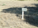
030405 153103481 viewsMcLachlan, station located at the 156 km, originally opened in September 1914 and called 97 Miles till 1915, closed in August 1972, April 5, 2003.
|
|
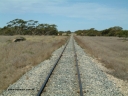
030405 153114456 viewsMcLachlan, station located at the 156 km, originally opened in September 1914 and called 97 Miles till 1915, closed in August 1972, view looking south with remains of loading ramp at left and square W boards for 'whistle', April 5, 2003.
|
|
|
|
|
|
|
 Login


