 Most viewed - 030406 |
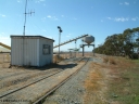
030406 101028522 viewsCummins, view looking from Cummins of the grain bunker rail unloading facility with dual DOH 'Drive Over Hopper' and stackers for loading road vehicles and with the original overhead outflow bin and feed conveyor for loading rail waggons. Loaded bunkers visible on the left. April 6, 2003.
|
|
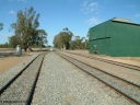
030406 095704520 viewsCummins, yard view looking south, Buckleboo line - siding converging with mainline in the middle with grain siding on the right. Train control concrete booth on the left, Railway Tce grade crossing, green possible former fertiliser shed. April 6, 2003.
|
|
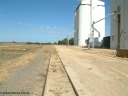
030406 142314520 viewsKapinnie, yard overview looking east towards Yeelanna, concrete silo complexes and outflow spouts on the right. April 6, 2003.
|
|
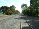
030406 094216518 viewsCummins, yard view looking north along the Buckleboo line with the Thevenard line second from the right with Hall St grade crossing visible in the distance and the loading ramp siding converging at the far left of the image. April 6, 2003.
|
|
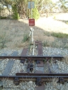
030406 092433517 viewsYeelanna, detail view of the points, lever and indicator and track fixtures for the south leg of the triangle. April 6, 2003.
|
|
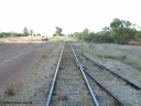
030406 092548517 viewsYeelanna, yard view looking south along the mainline, with points and converging track from the station siding visible on the right, and the points, lever and indicator for the diverging line to Kapinnie and former Mount Hope branch curving to the right. April 6, 2003.
|
|
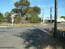
030406 094958517 viewsCummins, Hall Street grade crossing, looking south, point lever and indicator visible for the grain siding off the mainline, branch line to Buckleboo is the near track. April 6, 2003.
|
|
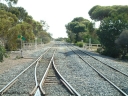
030406 094634516 viewsCummins, track view looking north at the north end of the yard, Thevenard line curves away to the left while the Buckleboo line curves away to the right across the pedestrian crib crossing. The points, lever and indicator are for the crossovers which form the crossing loop. April 6, 2003.
|
|
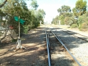
030406 094830513 viewsCummins, yard overview looking south down the Buckleboo line with the mainline from Thevenard on the right, with points, levers and indicators for the crossover and then the grade crossing on Hall St being visible, concrete silos in the distance. April 6, 2003.
|
|
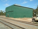
030406 095712513 viewsCummins, view of green possible former fertiliser shed. April 6, 2003.
|
|
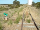
030406 141824513 viewsKapinnie, station yard overview looking east towards Yeelanna, from the terminus end of line with dwarf point lever and indicator, concrete silo complexes with outflow spouts, scotch block visible on siding. April 6, 2003.
|
|
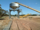
030406 100902512 viewsCummins, view of the grain bunker rail unloading facility with dual DOH 'Drive Over Hopper' and stackers for loading road vehicles and with the original overhead outflow bin and feed conveyor for loading rail waggons. April 6, 2003.
|
|
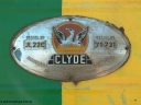
030406 114230510 viewsPort Lincoln loco workshops, builders plate for NJ class NJ 4 Clyde Engineering EMD model JL22C serial 71-731. April 6, 2003.
|
|
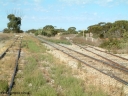
030406 092756508 viewsYeelanna, yard view looking south, shows mainline and grain siding running south and branch line to Kapinnie and former Mount Hope branch curving away to the right across a culvert and past a cast Yard Limit sign. April 6, 2003.
|
|
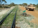
030406 103614508 viewsEdillilie, track view looking south from the south end siding points. April 6, 2003.
|
|
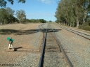
030406 100148506 viewsCummins, track view looking south along the mainline, points, indicator and lever for the grain bunker loading - unloading site which is behind the trees to the left, goods and grain siding on the right. April 6, 2003.
|
|
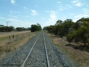
030406 101352506 viewsCummins, view looking north towards yard from southern end concrete train control booth. April 6, 2003.
|
|
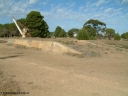
030406 091638504 viewsYeelanna, goods loading ramp and 5 ton jib crane, circa 1936. April 6, 2003.
|
|
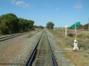
030406 100404504 viewsCummins, track view looking south, points, lever and indicator for the goods and grain siding, on the left the grain bunker loading - unloading site track can be seen curving away to the left. The Todd Highway is at the far right. April 6, 2003.
|
|
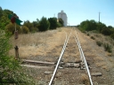
030406 142638504 viewsKapinnie, station located at the 105 km, this is the second location and in use from 1954. Station yard overview looking west with point lever and indicator and concrete silo complexes and outflow spouts. April 6, 2003.
|
|
|
|
 Login


