 Most viewed - Pilbara negative and digital Albums - non iron ore |

140517-4380530 viewsMarble Bar, Prospector Creek, tin mine, near Fishers Cairn the area was a Tailings Lease #10 (87H) - FISHERS CAIRN held by Moolyella Tin Pty. Ltd in the 1960s, then a machinery lease in the 1970s. Remains of a dry tin concentrate plant. Location Here.
|
|

205-33530 viewsKoodaideri, area around this underground drive, drive location is 22 31'48.36" S 118 59'58.08" E.
|
|

160102 9816530 viewsWittenoom Gorge, Town Pool in Joffre Creek just south of the Colonial Mine. Geodata.
|
|

160102 9826530 viewsWittenoom Gorge, eastern wall of gorge view, around Fifth Crossing. Geodata.
|
|

204-30529 viewsPort Hedland, 42 Kingsmill Street, this house was bought for $102,000 in 2000, and sold for $900K 10 or 11 years later.
|
|

205-25529 viewsDrillers Ridge, Wittenoom, the DME (Distance Measuring Equipment) tower (located at 957 metres) was a navigation aid for the Department of Civil Aviation for the Wittenoom airport, the site was also used by Telecom for providing 'radio links' for phones into Wittenoom prior to the current tower located at the eastern edge of town which links back to Auski Roadhouse.
|
|

160102 9831529 viewsWittenoom Gorge, eastern wall of gorge view, around Fifth Crossing. Geodata.
|
|

237-21529 viewsPilga Station ruins and old buildings. Geodata .
|
|
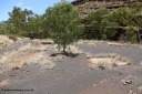
160101 9803528 viewsWittenoom Gorge, Gorge Mine area, old building slabs and foundations looking east. GeoData.
|
|

160102 9822528 viewsWittenoom Gorge, eastern wall of gorge view, around Fifth Crossing. Geodata.
|
|

160102 9824528 viewsWittenoom Gorge, eastern wall of gorge view, around Fifth Crossing. Geodata.
|
|

205-22527 viewsWittenoom, upper reaches of Bee Gorge, landscape views.
|
|

206-24527 viewsThe signs for Telfer, along the same lines as the Woodie Woodie signs.
|
|
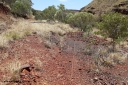
160101 9801527 viewsWittenoom Gorge, Gorge Mine area, looking east along the north wall with the drive line to the adits, old rails embedded in track. GeoData.
|
|

237-22527 viewsCoongan River crossing looking north east, Comet Mines are behind those hills. Geodata .
|
|

198-27526 viewsPort Hedland Port, view across hard stand area, shows tug pen and BHP Transport admin building, locals will also notice Customs House, new bulk loader under construction.
|
|

160711 iPh5S 2828526 viewsWittenoom cemetery located in the grounds of the old airport alongside the old north-west/south-east running runway. Sign placed in 2015. Location is here.
More details can be found on these two websites, Oz Burials, and WA4WD.
|
|

160102 9827525 viewsWittenoom Gorge, eastern wall of gorge view, around Fifth Crossing. Geodata.
|
|

254-09525 viewsWodgina mine site, bull buggy from a cut down FJ45 series Toyota Landcruiser from Wallareenya Station.
|
|

160710 iPh5S 2798524 viewsWittenoom Gorge, Colonial Mine, reverse view of 2797 looking north east back over the underground railway points on the upper level with the old building frame in the background.
|
|
| 547 files on 28 page(s) |
 |
|
|
|
|
|
|
|
|
|
|
|
24 | |
|
|
|
 Login


