 Most viewed - Pilbara negative and digital Albums - non iron ore |

160101 9763721 viewsWittenoom Gorge, Joffre Creek, Fourth Crossing Pool view of the western wall gorge, via Bolitho Road. Geodata: -22.2804483 118.3212850
|
|
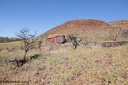
140517-4309720 viewsEginbah Siding area, of the Marble Bar railway, former locomotive watering stop alongside the Talga River (closed in 1951), view of the line formation block fill and tanks on collapsed stands. Location here.
|
|

197-17720 viewsWittenoom, Colonial Mine, asbestos mining remains, view looking across the drivers seat of Mancha battery locomotive #4 down the gorge towards Joffre Creek with the workshops building in the distance and some air under the dump track.
|
|
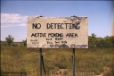
237-05720 viewsSign at the turn off to Western Shaw Mining Area at Tambourah on the Hillside - Woodstock Road. You get the idea, if you can't understand it you probably shouldn't be out here. 12th Feb, 2003. Geo Data
|
|
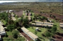
194-37718 viewsYandi campsite for Henry Walker operated iron ore mine owned and managed by BHP, view of camp are from man cage on Kato 50 tonne hydraulic crane.
|
|

196-18718 viewsWittenoom Gorge, view from Joffre Creek looking at the power station generator hall, the Gorge Mine is located further up Wittenoom Gorge to the right towards Karijini National Park.
|
|
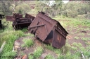
196-20718 viewsWittenoom Gorge, Gorge Mine area, asbestos mining remains, view inside of side opening ore waggon, shows how much ore the waggons could carry.
|
|
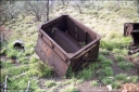
196-22717 viewsWittenoom Gorge, Gorge Mine area, asbestos mining remains, view inside of side opening ore waggon, shows how much ore the waggons could carry.
|
|
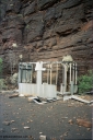
195-32716 viewsWittenoom, West Gorge, Australian Blue Asbestos or ABA Colonial Mine, remains of a building on the adit level adjacent to no. 30.
|
|

197-23716 viewsWittenoom, Colonial Mine, asbestos mining remains, view of the points leading to the mine adit on the right, and past the discharge slide chute on the left. The loop road is visible in the distance, with the demolished underground offices and lamp room pushed up against the gorge wall. Mancha #4 in the distance.
|
|

204-06715 viewsYampire Gorge, road out of the mining area with warning sign, Toyota HJ75 Landcruiser ute, PH 5090.
|
|
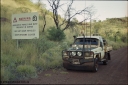
204-11715 viewsYampire Gorge, road out of the gorge area with warning sign, Toyota HJ75 Landcruiser ute, PH 5090.
|
|

194-21714 viewsWittenoom Gorge, Colonial Mine, asbestos mining remains, view of Mancha hauler with battery module open on ramp, view of driver's seat, controller, brake wheel and the drive motor inside the locomotive.
|
|
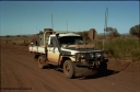
195-01712 viewsMunjina, end of Roy Hill Road where it meets the Great Northern Highway, Toyota HJ75 Landcruiser, loaded up to the max, it has a 13 leaf spring pack on the rear, 9 on the front, PTO winch, in route to Wittenoom.
|
|
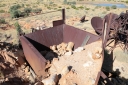
140517-4355711 viewsMarble Bar, Prospector Creek, tin mine, near Fishers Cairn the area was a Tailings Lease #10 (87H) - FISHERS CAIRN held by Moolyella Tin Pty. Ltd in the 1960s, then a machinery lease in the 1970s. Remains of a dry tin concentrate plant. Location Here.
|
|

204-08711 viewsYampire Gorge, road out of the mining area with warning sign, Toyota HJ75 Landcruiser ute, PH 5090.
|
|
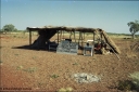
205-01711 viewsRoebourne - Wittenoom Road, Chichester Downs, camp located 4 km east of Rio Tinto railway, sign says it all.
|
|

160102 9818711 viewsWittenoom Gorge, pool in Joffre Creek just across the road from Colonial Mine, Magazine Pool. Geodata.
|
|

196-30710 viewsWittenoom Gorge, Gorge Mine area, asbestos mining remains, view of demolished building with railway tracks in air, site of former dump or unloading station.
|
|

140517-4327708 viewsEginbah Siding area, of the Marble Bar railway, looking towards Marble Bar along the alignment. Location here.
|
|
| 547 files on 28 page(s) |
 |
|
|
|
|
7 | |
|
|
|
|
|
|
|
|
|
|
 Login


